If you dream about stepping from your back deck onto a boat or walking to a sunset beach, Bonita Springs puts that lifestyle within easy reach. You get a small-city pace with big-water access and a network of bays, creeks, canals, and gulf shoreline that shapes everyday life. In this guide, you’ll learn what living on the water in Bonita really looks like, from boating and beaches to property types, permits, insurance, and seasonal rhythms. Let’s dive in.
Where waterfront living happens
Bonita Springs sits along the northern edge of Estero Bay with direct reach to the Gulf of Mexico. The area’s water is a mix of gulf-front beaches, protected bays, the Imperial River, and manmade canals. Estero Bay Aquatic Preserve protects seagrass flats, mangrove islands, and shallow creeks, which means calm paddling water, incredible wildlife viewing, and marked channels that guide boaters through sensitive areas.
Public beach days center on Bonita Beach Park, the city’s main gulf access with posted hours, fees, and current rules managed by Lee County. If you are planning your routine, check Bonita Beach Park details for parking and any seasonal updates.
Everyday waterfront lifestyle
Boating made simple
You can keep your own boat, join a boat club, or mix both. Bonita Bay Marina is a full-service hub that offers slip options, fueling, and dock-and-dine access. If you want a turnkey route without the ownership costs, local boat clubs operate in the area and make it easy to get on the water with a reservation.
Public ramps add flexibility. The Imperial River boat ramp connects you to Estero Bay and the gulf through marked channels. Lee County manages public facilities, and the Parks Program Guide lists ramp locations and notes on parking. Plan tidal windows and be patient during peak-season mornings when lines are common.
Practical boating tip: Estero Bay is shallow, with seagrass and oyster habitats. Local knowledge and shallow-draft boats help you avoid groundings. Respect posted speed zones and wildlife buffers inside the preserve to protect habitat and your prop.
Beaches, paddling, and the Blueway
Bonita Beach Park offers convenient gulf access for sunrise walks, sunset swims, and family beach days. Nearby, Lovers Key State Park adds trails, kayak launches, and more beach to explore. Expect different rules and passes between county and state sites, so confirm before you go.
For paddling, you can launch on the Imperial River and explore mangrove creeks and calm flats throughout Estero Bay. These routes are part of the region’s broader paddle network and make it easy to spot manatees, dolphins, and wading birds on quiet mornings.
Fishing and wildlife etiquette
Inshore anglers target snook, redfish, and seasonal tarpon around mangrove shorelines, oyster bars, and passes. A saltwater license and adherence to bag and size limits apply. Learn more about local patterns and species on Estero Bay fishing overviews.
Wildlife protections are a normal part of waterfront life. Expect seasonal sea turtle and shorebird nesting zones on parts of Bonita Beach, plus manatee speed areas in local waterways. Keep lights low on the beach during nesting season, obey roped areas, and watch for speed signs when you boat.
Dock-and-dine favorites
Pull up to a slip and enjoy lunch outside. The Bonita area has a casual dock-and-dine culture with waterfront patios and marinas that welcome boaters. Policies vary by venue, so it is smart to call ahead for slip availability. For inspiration, browse regional highlights on waterfront dining in Fort Myers and Bonita.
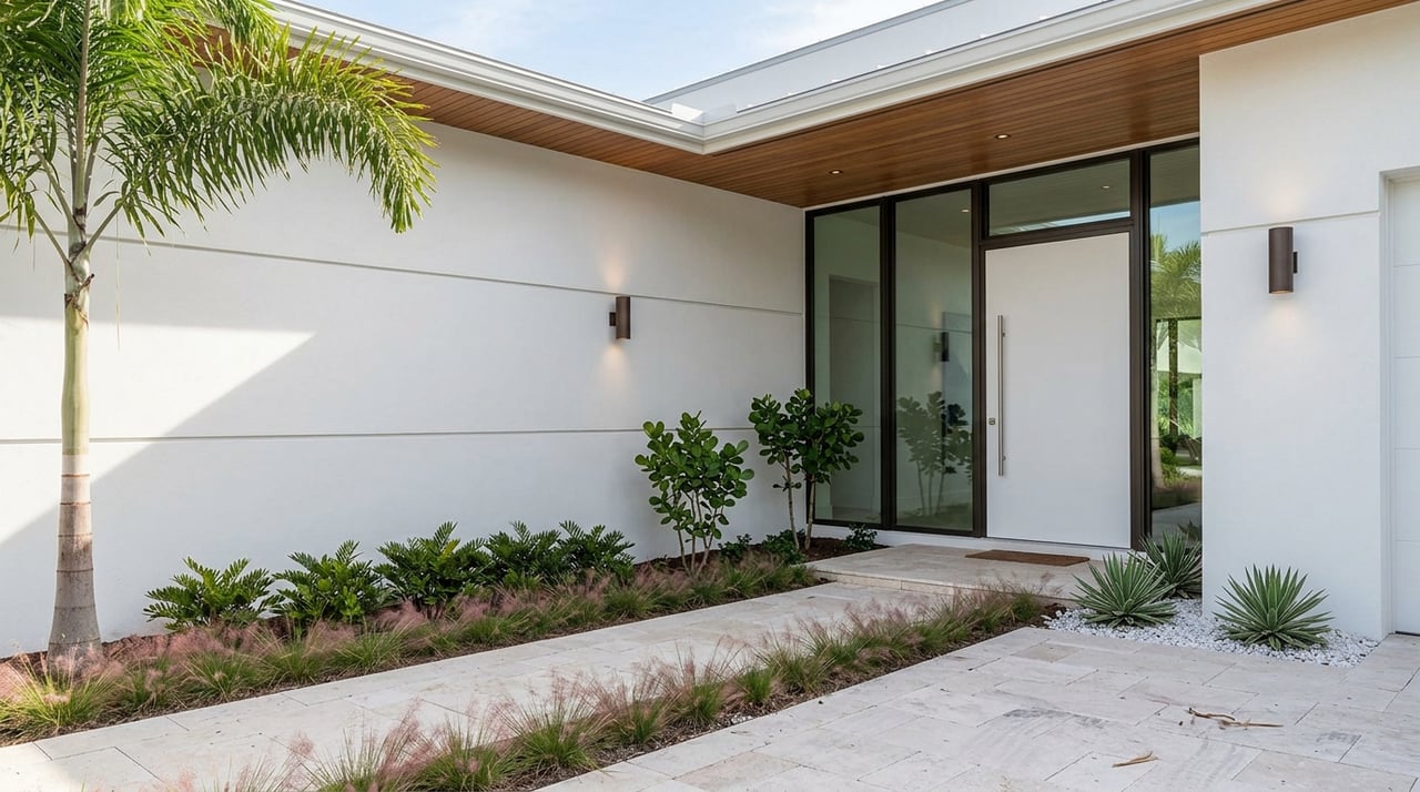
Choosing your waterfront property
You have several distinct waterfront settings in Bonita Springs. Each offers different views, access, and ownership considerations.
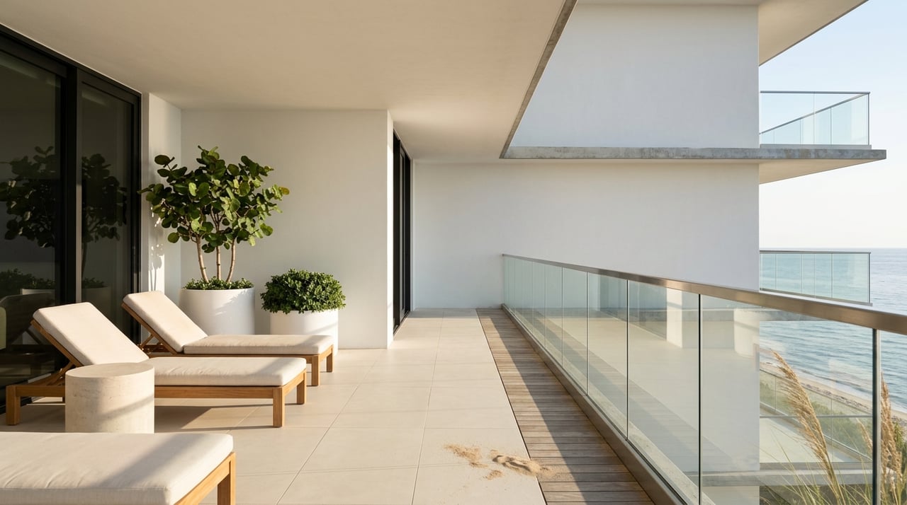
- Gulf-front: Direct beach and sunset views with easy sand access. Tradeoff is more exposure to wind, surf, and storm surge. Maintenance and insurance can be higher, and shoreline projects may affect access during construction.
- Bayfront: Big-water scenery with calmer conditions and protected views. Often easier access for small boats and kayaks. You still need to respect shallow flats and marked channels.
- River and canal: Private dockage and lifts are common. You can reach the bay year-round, often with easier daily boating. Draft and bridge clearances are key planning points.
Because Estero Bay is a protected aquatic preserve, waterfront settings vary block by block based on channel proximity and habitat buffers. That is part of Bonita’s charm and why a local guide can help you weigh tradeoffs for your lifestyle and boat type.
Flood maps, permits, and shoreline work
Waterfront property requires an extra layer of due diligence. Many gulf-edge and low-lying parcels fall in FEMA-designated flood zones that affect lending and insurance. To see how a specific address maps, review Lee County’s FIRM panel resources or consult the FEMA Map Service Center.
Shoreline projects and structures are regulated. Work on seawalls, docks, lifts, and anything seaward of established control lines usually requires permits. The Florida Department of Environmental Protection and local agencies administer coastal construction guidelines. Start with the DEP’s program index to understand who oversees what, then coordinate with the county for local rules.
Beach nourishment and repair projects also occur from time to time, often after storms. These efforts can temporarily affect access, parking, and beach width, then improve resilience and walkability once complete. Lee County posts public notices so residents know schedules and closures.
Ownership costs and planning
Budgeting for waterfront ownership is as much about maintenance planning as it is about the mortgage. Typical ongoing items include:
- Dock and boat-lift service schedules
- Seawall or bulkhead inspections and repairs
- Elevated foundation or structural requirements in higher-risk zones
- Hurricane shutters or impact-glass upgrades
- Homeowner and flood insurance that reflect your site’s flood zone
- Potential HOA assessments after large storm events in managed communities
Exact numbers change with market conditions and property details. A quick call to your insurer, dock contractor, and HOA manager can give you current estimates for your shortlist of homes.
Seasons that shape life
Seasonality is part of Southwest Florida’s rhythm, and it shapes how you plan waterfront days.
- Visitor season runs roughly December through April. Beaches, ramps, and restaurants are busier. Expect more competition for boat slips and dinner reservations.
- The Atlantic hurricane season runs June 1 through November 30, with higher activity most years in August to October. Get timelines and preparedness tips from the National Hurricane Center’s climate page. Many owners set routines for shutters, generators, insurance reviews, and boat storage ahead of peak months.
- Wildlife seasons bring night lighting rules on the beach and speed zones on local waterways. You will see posted signs on beaches and channels with current guidance.
Bonita Springs vs nearby towns
Bonita Springs delivers a relaxed, mixed-waterfront lifestyle with easy paddling, fishing, and dock-and-dine options. You get quick access to protected bays and barrier-island beaches with a smaller-city feel.
- Fort Myers Beach to the north has a livelier island vibe with more tourist activity and nightlife. If you want that energy, it is a quick drive or boat ride while keeping a quieter home base in Bonita.
- Naples to the south trends more resort-oriented with a strong luxury retail and dining scene, private beach clubs, and a significant gulf-front condo market.
- Sanibel and Captiva are conservation-focused and known for shelling with stricter development patterns. Many people split time between Bonita’s recreational mix and those islands’ slower pace.
How a local expert helps
Waterfront value in Bonita is more than a view. The details matter: channel depth to your dock, bridge clearances, rental rules, flood maps, HOA strength, recent nourishment work, and the true cost of insurance and maintenance. A knowledgeable partner helps you match the right property to your boating style, risk tolerance, and long-term plans.
As a third-generation Southwest Florida local with more than $500 million in sales and nearly 1,000 transactions, our team brings street-by-street perspective to Bonita’s bays, canals, and beach corridors. We help you compare property types, confirm access and permitting paths, and move forward with confidence.
Ready to explore on the water in Bonita Springs? Reach out to the Alex King Luxe Group to talk through your goals and see the best current opportunities.
FAQs
What types of waterfront homes are in Bonita Springs?
- You will find gulf-front condos and homes, bayfront single-family properties, and river or canal homes with private docks, each with unique access, views, and maintenance needs.
How does flood insurance work for Bonita waterfront homes?
- Many gulf-edge and low-lying parcels fall within FEMA flood zones that trigger lender requirements for flood insurance; check Lee County’s FIRM panel resources for parcel-level context and get a current quote.
Where can you launch a boat in Bonita Springs?
- The Imperial River public ramp connects to Estero Bay, and smaller kayak launches sit near parks; see locations and notes in Lee County’s Parks Program Guide.
Are Bonita Beach and Lovers Key access rules the same?
- Rules vary by jurisdiction; check Lee County for Bonita Beach Park details and Florida State Parks for Lovers Key information before you go.
When is hurricane season in Southwest Florida?
- The Atlantic season runs June 1 through November 30, with peak activity often in August to October; see the National Hurricane Center for climatology and planning tips.
Can you enjoy boating without owning a boat in Bonita?
- Yes. Full-service marinas and local boat clubs provide turnkey access for part-time or new residents; start with Bonita Bay Marina and compare club options nearby.